Uganda – First, real, Muzungu experience

Pripreme za odlazak u Ugandu su bile sve osim uobičajne. Nažalost, ponukan predrasudama i stereotipima o ovoj Afričkoj zemlji pripreme su krenule puno ranije od uobičajnih i mnogo detaljnije nego inače. Uobičajna pripreme izgleda nekako ovako: „Unlock a phone, check a weather in the country I going in and pack my luggage“! Ništa posebno i ništa detaljno se ne istražuje, bar ne u mom slučaju. Ovaj put, istraživanje je odrađeno detaljno, od samog života u Africi, temperature, vremena, zaraza, bolesti u Ugandi, zemljama kojim je okružena i svim ovim detaljima za iste te zemlje. Nakon toga je uslijedila vakcinacija, pripremanje kojekakvih tableta i sprejeva kako bi se „zaštitio“ od „nepoznatog“ i slično, ali eto kad čovjek ide u nepoznato, valjda se treba i pripremiti. O zanimljivostima i nekim činjenicama o Ugandi pogledajte u mojoj sekciji „zanimljivosti“…Pripreme za odlazak u Ugandu su bile sve osim uobičajne. Nažalost, ponukan predrasudama i stereotipima o ovoj Afričkoj zemlji pripreme su krenule puno ranije od uobičajnih i mnogo detaljnije nego inače. Uobičajna pripreme izgleda nekako ovako: „Unlock a phone, check a weather in the country I going in and pack my luggage“! Ništa posebno i ništa detaljno se ne istražuje, bar ne u mom slučaju. Ovaj put, istraživanje je odrađeno detaljno, od samog života u Africi, temperature, vremena, zaraza, bolesti u Ugandi, zemljama kojim je okružena i svim ovim detaljima za iste te zemlje. Nakon toga je uslijedila vakcinacija, pripremanje kojekakvih tableta i sprejeva kako bi se „zaštitio“ od „nepoznatog“ i slično, ali eto kad čovjek ide u nepoznato, valjda se treba i pripremiti.

Naravno, prije svega gore navedenog morao sam provjeriti „gdje i kako se vadi VIZA za Ugandu“?! Nažalost, mi kao Bosanci i Hercegovci uvijek imamo problem oko viza i putovanja do destinacija, ali ko je spreman putovati, spreman je svašta nešto uraditi da bi otputovao. Ovaj put sam imao sreće, jer se viza za Ugandu vadi online putem, i cjeli proces traje 2 puta po 10 minuta. Nakon što unesete sve podatke i „submitujete“ aplikaciju, nekoliko dana/sedmica poslije pošalju vam mail i traže da učitate pozivno pismo, potvrdu o smiještaju i karte. Zbog toga rekoh 2×10 min.

Pošto baš i nemamo Bog zna kakvih konekcija za putovanja avionom ovako je izgledao moj put:

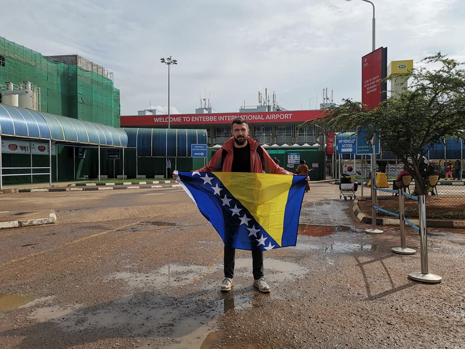
Sarajevo – Istanbul – Rome (Turkish Airlines) – Addis Ababa – Entebbe (Ethiopian airlines) – Kampala (auto) i istim takvim putem nazad.

Po samom izlasku sa Entebbe aerodroma dočekala me je jako velika vlažnost zraka i nekakva čudna temperatura. Nisam bio svjestan da li je pretoplo ili „zagušljivo“, ali bilo je jako neugodno. Kada sam stigao u Kampalu, odnosno u „Green House“ (kuća/hostel) u kojem sam bio smješten, u sobi gdje sam trebao spavati primjetio sam krevet sa „mrežom“, istom onom koju roditelji stavljaju na dječije krevetiće da ih zaštite od kojekakvih „baja“. U tom trenutku sam se osjetio totalno ugrožen, jer „ne bi ta mreža bila tu da to stvarno nije ozbiljno HAHA“! Nakon toga, bio sam spreman da pri svakom izlasku prionem na „prskanje“ svim mogućim „anti…“ sprejevima. Naravno, to se desilo samo prvi dan dok nisam shvatio da to i nije toliko strašno, pa sam ostalih dana sprejeve koristio samo kao preventivnu zaštitu u totalno normalnoj mjeri.

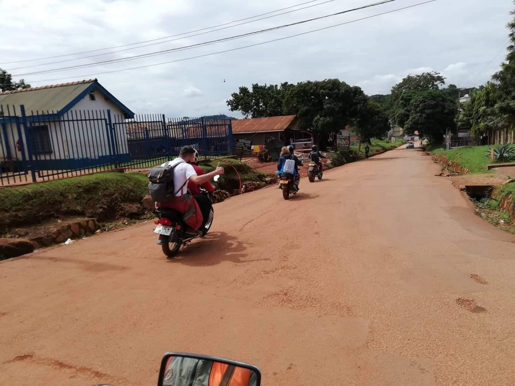
U svom boravku u Kampali imao sam priliku posjetiti jako mnogo različitih mjesta i plemena, gdje sam upoznao veliki broj različitih, a istih ljudi, imao sam priliku osjetiti život „centra Kampale“, ali i plemena do kojih se putuje i po par sati. Svaki odlazak u grad je bio poseban, jer je bilo nemoguće korisitit normalan „taxi ili uber“, već smo koristili „boda boda uber/taxi“ koji je mnogo praktičniji i jednostavniji za putovanje po gradu. BODA BODA su motori koji se koriste kao uber i taxi u Ugandi i to je najviše korišteno prevozno sredstvo u ovom djelu kontinenta. Ova vrste prevoza se najviše koristi zbog jako velikih gužvi u saobračaju, te jako loših puteva, gdje možete naići i na rupe veličine automobila i dubine preko pola metra. Prema lokalcima rupe su nastale i nastaju zbog jako lošeg kvaliteta puta kojeg su gradili kinezi, te velike vlage koja kroz taj materijal lako prodire i pravi uvale. Bogataši se naravno voze velikim džipovima i „lete“ preko rupa, dok obični smrtnici koji su nekako kupili po neki japanski automobil prelaze preko rupa i po par minuta.

Više o važnim faktorima i zanimljivostima pogledajte u rubrici „zanimljivosti“, a da nastavljam svoju priču…

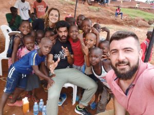
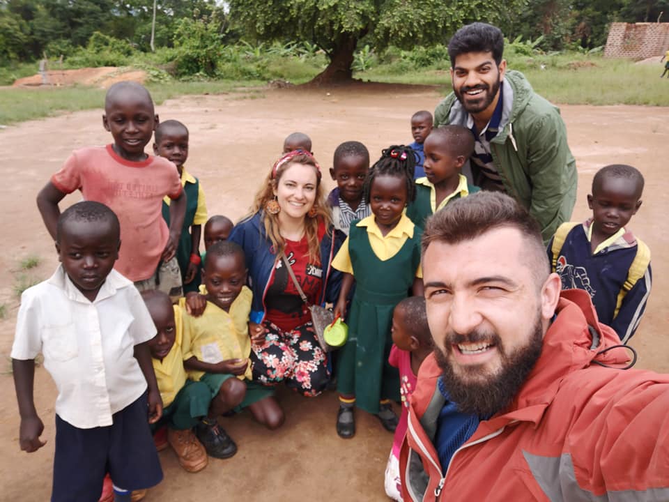
Gdje god sam se pojavio sa svojom ekipom „bjelaca/Evropljana“ dočekani smo dječijim uzvicima „MUZUNGU“, što bi ti ga značilo „BJELI LJUDI“. Naravno, mi to nismo shvačali kao rasizam, već smo se uvijek nasmijali i prišli toj djeci koja su te riječi izgovarali jako nasmijani i „iznenađeni“. Pri prilasku, djeca su prije svega bježala ili se odmicala, pa su tek naknadno prilazili i pozdravljali se sa nama. Jako je teško bilo napraviti sliku sa samo jednim djetom, jer su svi uvijek uskakali i željeli se slikati sa nama. Imao sam priliku obići nekoliko plemena, a jedno mi se posebno dojmilo „Lugala Sugu” o kojem sam pisao i na Facebooku, pa da se ne bih ponavljao prenosim post u cjelosti:

Danas sam bio u posjeti jednom selu pod imenom Lugala Sugu do kojeg se može doći samo čamcem, takozvanim kanuom preko jezera Viktorija (ime nastalo kolonizacijom Ugande).

Posjetili smo nekoliko porodica, koje su nas zamolile da ih ne slikamo, jer im je neprijatno, a neki nisu dopustili iz straha. Naravno, jedan nas “domaćin” nam je to dozvolio, objasnio sta se dešava u tom selu, kako žive bez struje, kako se “bore” sa vodom i kako je to živjeti odvojeno od civilizacije. Predstavio nam je njihovo voće, koje većinom i on sadi u svojoj bašti, objasnio koje životinje se nalaze u šumama okolo i kakva sve plemena postoje.

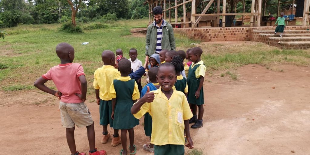
Nakon toga smo posjetili jednu školu, koja je nastala kao jedna ideja/projekat da se djeci koja su udaljena od “prave škole” ponudi osnovno obrazovanje. Malo smo se družili sa djecom koja su nam neprestano mahala, trčala u zagrljaj i onako iskreno nas nazivala MUZUNGU (bijeli ljudi).

Nakon toga vratili smo se u “civilizaciju” gdje smo obišli određene građevine i pričali sa lokalcima o kvalitetu života, poslu i slično.

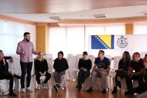
Popodne smo otišli u Design HUB koji okuplja ljude svih boja, rasa, vjera itd. gdje smo obavili finalne pripreme za sutrašnji dan.

Ako niste znali oficijalnih jezik u Ugandi je Engleski, tako da nam je jako lako razumjeti lokalce, ako ste se do sad pitali ko nam sve to prevodi. Naravno, imaju i svoj lokalni, te svako pleme ima svoj “zasebni” jezik.

Čak sam uspio i da naučim par riječi:

Vebalenjo – hvala
KARE = OK
BODA BODA – taxi
MZUNGU – bijeli ljudi

Uskoro donosim još informacija i detalja iz ovog kraja svijeta….

Bili u civilizaciji ili van nje, bili u plemenu ili u HUB-u dočekat će vas osmjesi i dragi pogledi, na njihovim licima jako teško je primjetiti tugu i žalost, već sve suprotno tome. Svi su spremni pomoći, svi žele dati svoj doprinost da se u ovoj siromašnoj zemlji osječate sretni i zadovoljni, svi žele pokazati gostoprimstvo i svoju sreću. Što se tiće mene, oni su to i uspjeli, sve ovo su prenijeli na mene i pomogli su mi da razumijem njihovu kulturu i državu puno bolje nego sam to znao prije.

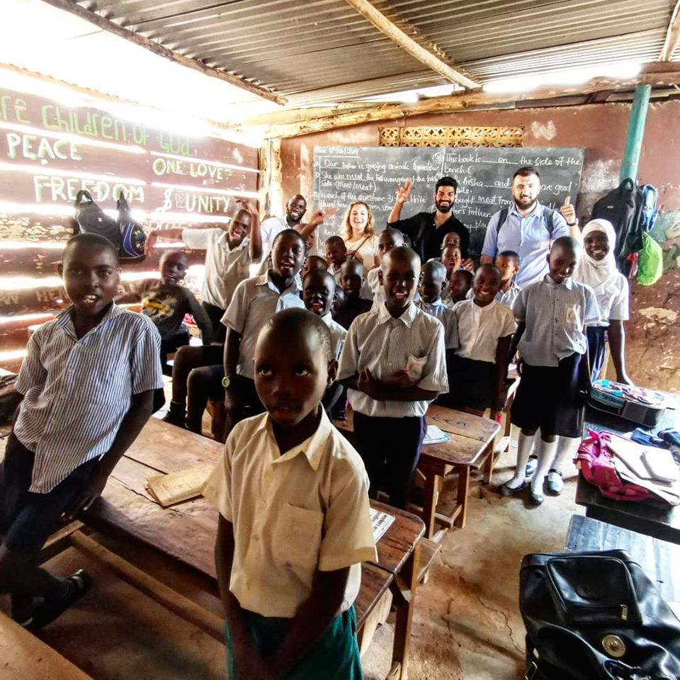
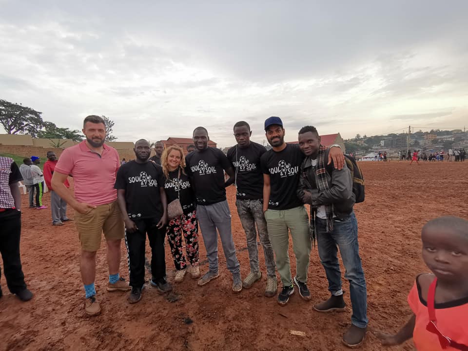
Boraveći u Kampali imali smo priliku posjetiti i nekoliko škola i edukativnih centara, koji naravno liče na sve osim na školu, ali bitno je da se ljudi obrazuju i edukuju. Pored svega što smo uradili u Kampali, mi smo izrazito došli sa projektom kako bi povezali razna plemena koja i nisu u tako dobrim odnosima kroz sport, pa smo tako uspjeli organizovati i turnir u fudbalu. O tome sam takođe pisao na Facebooku, pa ponovo prenosim post u cjelosti:

Današnji dan u Ugandi sam ponovo posvetio djeci i omladini koja dolaze sa ruralnih područja ovog grada, sela i mladih ljudi koji su u teškom finansijskom i socijalnom stanju.

Kako bi održali jednu jako korisnu edukaciju i skupili mlade ljude, tinejdžere i djecu iz tih područja i plemena, koji danonoćno rade kojekakve poslove kako bi preživjeli morali smo naći pravi način i napraviti sistem.

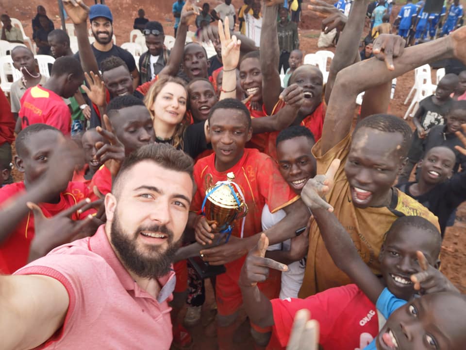
Kako biva u većini slučajeva, gdje god se pojavi mržnja i netrpeljivost, sport i sportske aktivnosti dođu, to pobjede i razbiju sve predrasude. Mi smo se vodili tom logikom i za samo nekoliko dana u suradnji sa #PCCP-om i #SoulXpressions-om, u koordinaciji #MineVagantiNGO, koji je i začetnik cijele ove priče napravili smo veliku stvar. Uspjeli smo organizovati turnir u fudbalu, okupiti razne “mahale” i plemena, organizovati ljude, pripremiti nagrade i obradovati kako mnogu djecu, tako i njihove roditelje i plemena.

U organizaciju su se uključili svi, ali bukvalno svi. Roditelji su donosili “UGALJ” i zajedno sa omladinom ocrtavali teren, pa eto ako niste znali oni tako markiranu linije. Našli su ozvučenje, skupili stolice i šatore, stavili mreže na golove, donijeli klupe, sportski klubovi su dali dresove, mi podijelili majice i turnir je bio spreman za jako kratko vrijeme.

Utakmice su krenule po suhom i prasnjavom terenu koji uopće nije prijatan, ali nakon nekoliko utakmica počela je kiša, koja je od prašine napravila blato, koje je izgledalo katastrofalno. Sve ovo, a moglo bi se dodati još stvari koliko želite nije zaustavilo ove omladince da prestanu igrati jedne sekunde. Na kraju jedna “mahala” je dobila svog pobjednika, ali su se svi radovali, jer su i oni svjesni da su svi pobjednici.

Kao što možete vidjeti na slikama ispod, fudbalski teren je bio ispunjen djecom koja su se borila ko ce donijeti loptu, roditelja i prijatelja koji su bodrili mladice koji su se u bladu do grla borili za pehar i ostale nagrade. Naravno, bit svega je bio okupiti ih i svima na jednom mjestu održati jednu korisnu edukaciju. PROJEKAT je nazvan “#SOULandSOIL” – EDUKACIJA KROZ SPORT, a turnir #Kikubamutwe.

Nakon toga posjetili smo i jednu školu plesa koja okuplja djecu i mlade iz socijalno ugroženih područja, siromašnu djecu i mlade iz raznih plemena.

Nakon druženja napravili su jedan jako lijep performans za nas i pokazali svoje vještine plesanja.

Ja smatram da smo uspjeli i da su MZUNGI ovaj put uradili nesto korisno za njihovu zajednicu i povezali lokalne zajednice i plemena. Mi smo zaboravili i na hranu i piće, pa smo doručkovali tek nekad u vrijeme večere, ali gledajući svu tu strast i želju, kao i okruženje u kojem smo bili, nisamo uopće osjetili potrebu za tim.

Život je ovdje sigurno težak, ali je pun ljubavi i sreće, tako da ne gledajte koliko imate, nego koliko dajete.

Šaljem vam ljubav iz ovog drugog svijeta, čudne ali i prelijepe Ugande.

#EducationThroughSport #InternationalCooperation #OneWorld #minevagantingo #mvinternational #SoulXpressions #PCCP #BRAVO #BRAVOBIH #BRAVOSARAJEVO

Iako je uganda jedna od najsiromašnijih zemalja svijeta, iako sve to vrlo lako možete vidjeti prolazeći ulicama van centra, to se nikako ne može primjetiti na ljudima, jer svaki susret sa njima počinje i završava sa smijehom, počinje sa lijepim riječima i završava sa plesom itd. Moram priznati da siromaštvo vlada ovom zemljom, ali ono materijalno, ono duhovno sigurno ne i siguran sam da i mi našu sreću trebamo tražiti u nećemo trećem, jer i oni sigurno od nekud crpe svoju energiju i želju za životom.

Priču iz Ugande želim završiti sa jendom od posljenjih rečenica iz mog posta: „Život je ovdje sigurno težak, ali je pun ljubavi i sreće, tako da ne gledajte koliko imate, nego koliko dajete.“

Kada kažem dajete, onda stvarno tako i mislim, jer vjerujte da i malim davanjem nekog možete jako mnogo usrećiti, nekada to vama znaći jako malo, a nekom i previše. Ako niste putovali u takve zemlje i osjetili kako to izgleda, siguran sam da nećete do kraja shvatiti šta to tačno znači.

Žao mi je što Bosanci često ružno govore o svojoj zemlji i kao da se takmičimo ko će više oblatiti život u Bosnia i Hercegovini, ali kada vidite šta je stvarno siromašna zemlja, onda je lako shvatiti da Bosna i Hercegovina možda i nije među najbogatijima na svijetu, ali nije ni među onim najsiromašnijim.

O zanimljivostima i nekim faktima o Ugandi pogledajte u mojoj sekciji „zanimljivosti“…

Ankara

Anitkabir is the mausoleum of Mustafa Kemal Atatürk, the leader of the Turkish War of Independenceand the founder and first President of the Republic of Turkey.

The mausoleum looks a lot like the Parthenon in Athens, with tall columns at its entrance. As the video illustrates, there were moments when horns blasted over the speakers and all of the visitors stopped to pay tribute to the Father of Turkey.

The site is also the final resting place of İsmet İnönü, the second President of Turkey, who was interred there after he died in 1973. His tomb faces the Atatürk Mausoleum, on the opposite side of the Ceremonial Ground.

It’s hard to not be impressed by this extravagant memorial. On the 69th anniversary of his death, over milion people visited the mausoleum to pay respect to the Father of Modern Turkey.

Think about that for a moment!

Istanbul

Beylerbeyi Palace

Beylerbeyi Palace on the Bosphorus Beylerbeyi Palace, summer residence of the sultans, is located at Beylerbeyi neighborhood on the Asian shore of the Bosphorus. It was ordered by the sultan Abdulaziz and built between 1861-1865 by head architects Sarkis Balyan and Agop Balyan, imperial architects of Armenian origins, in French neo-baroque style with a traditional Ottoman house plan. Important foreign guests visiting the Ottoman Empire were accommodated in this palace during the summer months; Prince of Serbia, King Nicholas of Montenegro, Emperor Joseph of Austro-Hungary, Shah Nasireddin of Iran, Prince Oscar of Sweden, and Empress Eugenie of France were some of them. Sultan Abdulhamid II spent the last 6 years of his life and died here in 1918, meanwhile other sultans ruled in the Dolmabahce Palace during winter months and came here only for the summer for a nice climate.

The palace has a rectangular plan with the long side facing the Bosphorus. There are 6 large halls and 24 rooms on two floors raised on a service basement which was originally used as a kitchen and storage. The palace is divided into mens’ section (Selamlik) and womans’ section (Harem) having separate entrances for both. The Selamlik was used for State functions therefore was very ornate, meanwhile the Harem was reserved only to the ladies and with a simple decoration.

Berlin

Brandenburg Gate is the first stop for every visitor to Berlin! The city’s iconic landmark offers fascinating insights into the city’s history.

The Brandenburg Gate is one of the most iconic sights in today’s vibrant Berlin. More than just Berlin’s only surviving historical city gate, this site came to symbolise Berlin’s Cold War division into East and West – and, since the fall of the Wall, a reunified Germany. Architecturally, the sandstone Brandenburg Gate also represents one of the earliest and most attractive examples of a neo-classical building in Germany.


History – the Brandenburg Gate

Constructed between 1788 and 1791, the Brandenburg Gate was Berlin’s first Greek revival building. Designed by Carl Gotthard Langhans, architect to the Prussian court, it was inspired by the monumental gateway at the entrance to the Acropolis in Athens. The Brandenburg Gate is 26 metres high, 65.5 metres long and 11 metres deep, and supported by two rows of six Doric columns.

In 1793, the gate was crowned by the Quadriga statue, designed by Johann Gottfried Schadow. This statue also has its own story to tell. In 1806, when Napoleon’s army took Berlin, the French Emperor had the Quadriga transported to Paris as war booty and a sign of his victory. In 1814, after Napoleon’s forced abdication, the Quadriga was returned to Berlin where it once again adorned the Brandenburg Gate, facing towards the east and the city centre.

In 1946, with the post-war division of Germany and Berlin, the Brandenburg Gate was in the Soviet sector. When the Berlin Wall went up in 1961, the Gate stood in an exclusion zone in an arc of the Wall, inaccessible for locals and visitors alike. When the Wall fell, 100,000 people gathered here for the Brandenburg Gate’s official opening on 22 December 1989 – and soon afterwards, crowds thronged the area to celebrate their first joint New Year’s Eve in this once-divided city. Today, more than almost any other of the city’s landmark sights, the Brandenburg Gate symbolises a reunited Berlin.

Sassari

One of the most important cities in the north of Sardinia. Sassari is well represented by its historical center, where you can admire buildings in different artistic styles: neoclassical, baroque, gothic, romantic.

Sassari is a beautiful and regal city. It’s a place you do not expect to find, with a thousand extraordinary surprises. As soon as you begin to walk in the city center you discover one of the most beautiful corners of Sardinia. You will fall in love with its history, monuments, green spaces, culture, tradition and for its cuisine that make it a unique destination to discover.

A controversial history made up of judicatures and maritime republics, realms, pirate invasions, great characters of both ancient and modern history of which the city can be proud.

It all started in 1131, when it appears in the Condaghe (stories) of San Pietro in Silki the name of Jordi de Sassaro.

It became a free city in 1236, promulgating under the domination of Pisans the Statutes of Sassari, a code that regulated the civil, legal and economic life of the citizens . This important document is written in Latin and Logudorese Sardinian.

There are only five copies of this manuscript, two of which date back to the foundation of the city. It was in this period that the city, disputed between the maritime republics, stipulated an act of confederation with the Republic of Genoa in 1294, and completed the walls for protection.

The Royal City of the Kingdom of Sardinia from 1331, still retains the traces of the passage of Aragon and the Spanish. The castle of Sassari, _ the seat of the Spanish Inquisition in Sardinia was demolished in 1877 and now only a few parts remain that still tell a piece of history of the bourgeoisie and of the Aragon presence: the foundations, and two corridors of the old wall that housed the artillery. After being invaded by the French in 1527, Sassari faced several periods of severe social and economic crisis, and was decimated by the plague in 1582. With the Treaty of Utrecht in 1713, it began a brief period of Austrian domination, then the Savoy took their place in 1720. Everything else is part of its cultural renaissance and urban development until the nineteenth century.

The city expanded beyond the walls, partially torn down during a cholera epidemic. Following the example of the capital city, Turin, new districts arose with a new hospital, prison, schools and town squares, and a new Civic Theater. Nearby Porto Torres was restored with the first ferry connections with Genoa and new entrepreneurship grew: it became the second most important city in Italy for the production of leather.

But there is more to Sassari than just its history: it is a city with at least twelve reasons for being so special …

… This is the city where the first university of Sardinia was born and still is the city of the young who can follow studies of excellence in law, agriculture and veterinary medicine.

… Its the city whose symbol is a fountain that is a true masterpiece: the Fountain of Rosello, previously famous as the major well of the area since 1295

… Its the city where the city gathering spot is a large nineteenth-century square, Piazza Italia, where the Palace of the Province and the neo-Gothic Palazzo Giordano overlook the city center

… Its the city where enormous Candlesticks, recognized by the UNESCO World Heritage Site, on August 14 are carried on the shoulders of the devout in a magic dance through the narrow and crowded streets of the city to the Cathedral of the city

… Is a city full of beautiful historical buildings built between the seventeenth and nineteenth centuries that host municipal offices and museums

… Its the city of politics and where presidents of the Italian Republic were born and raised. Here Enrico Berlinguer, Antonio Segni and Francesco Cossiga were born

… Its the city where you will find the command of the Brigata Sassari, whose origins date back to the First World War, when the Sardinians distinguished themselves in fierce fighting on the front that earned them numerous awards and citations for the first time in the Bulletin of the Supreme Command. Written for Sardinians, the hymn Dimonios (devils) commemorates the valor and courage typical of the islanders

… Its the city with the best fast food: the fainè

… Its the city that has a special prenuragic monument, Mount Accoddi, unique in all the Mediterranean with a pyramidal structure with steps similar to the ziggurat of Mesopotamia

… Its the city in whose territory is located the only natural lake in Sardinia: Lake Baratz

… Its the city in whose territory you can find the atmosphere of the Scottish highlands in the Argentiera

… Its the city in whose territory it is possible to see the Asinara Gulf with the crystal-clear sea of Sardinia and pink flamingos.

The most important monumental buildings are: the St. Nicholas Church, Palazzo Ducale, Palazzo Giordano, Piazza Italia and the Rosello Fountain. The St. Nicholas Church dominates the old town with its impressive, baroque façade containing the statues of martyrs in niches. There is a bell-tower beside the church. Its interior dates back to the XIII Century and is in the gothic style. Its external part was constructed in the XVII Century. Among the numerous works of art, there are also: a marble altar from the middle of the XIX Century, a Madonna del Bosco painting from the XIV Century, a Spanish crucifix from the XVIII Century and the mausoleum of Placido Benedetto di Savoia – Lord of Moriana, brother of Vittorio Emmanuele I and Carlo Felice, who died in Sassari in 1802.

Palazzo Ducale was built at the end of the XVIII and beginning of the XIX Centuries by Antonio Manca, the marquise of Mores and duke of Asinara, most likely according to Carlo Valino’s project. In 1900, the palace was purchased by the municipal administration and nowadays hosts the small town hall.
Palazzo Giordano was constructed in 1878 and is actually the headquarters of the Banco di Napoli. The beautiful rooms were decorated by Gugliemo Bilancioni.

Piazza d’Italia, constructed in 1872, spreads over 1 hectare and is also called “Sassari’s lounge (“il salotto di Sassari”) as it used to be an urban centre where new quarters were developed. There is the Province’s Palace (il Palazzo della Provincia), constructed between 1873 and 1880 and the statue of Vittorio Emanuele II – the work of artist Giuseppe Sartorio (1899).

The Rosello Fountain was constructed by craftsmen in the XVII Century in a time when there was no aqueduct in the most important point of the city. Considering the abundance of water, a wash-house was built beside it. Nowadays, the area is less important and in a valley overlooked by the Rosello Bridge. The fountain is covered with marble, its walls are decorated with 12 lions with water flowing from their mouths. Metaphoric statues of the 4 seasons are in each corner and a statue of St. Gavino on horseback rests on the peak of 2 intertwined arches.

There are very nice churches in the old town – especially St. Mary’s church where “candarieri” are kept (big, wooden machines that are carried during the procession by the historic neighbourhoods’ representatives, the 14th of August every year during the “festa manna”). Another church that is worth a visit is the beautiful cathedral of St. Nicholas recently opened to visitors after a long period of restoration.

Tanay

Staying on this rock I was trying to balance inspired by this place and people living here.

Balance…?

Are you familiar with that? Do you know what is it? To make it even more complicated, what about “Rock Balancing”? Have you heard about it? Sounds interesting right? Maybe you’ve tried balancing different stuffs but balancing a heavy and with various sizes and forms rocks, well it’s an extraordinary skills. The art of rock balancing is not an easy-breezy thing to perform considering that rocks are the most irregularly-shaped pieces on earth

In Tanay Rizal, just 57 kilometers east of Manila, 1 hour and 30 minutes’ drive, Rock balancing exists and it’s a popular.
As per Wiki: Rock balancing is an art, discipline, or hobby (depending upon the intent of the practitioner) in which rocks are balanced on top of one another in various positions. There are no tricks involved to aid in the balancing, such as adhesives, wires, supports, or rings.

In the Philippines, Rock Balancing was founded in September 2010. There were two proponents who popularized, organized and introduced this form of Art in Tanay, named Leandro Tamayo Inocencio and Ildefonso Bandoma Vista. These two names are advocates for greener and cleaner environment. The very reason why they introduced this art is not only performing or exhibiting it, yet to persuade the locals to support their project named “The Journey for The Trees” This Project tends to give awareness and promoting environmental awareness and life conservation through conducting such exhibition of Rock Balancing.

It was a success, a tree planting activities, lectures for environmental awareness, rock balancing and more in connivance with Municipality of Tanay, The Billion Tree Campaign, United Nations Environmental Program (UNEP), ), and the 350.org‘s 10-10-10 Global Work Party, and innumerable sponsors and volunteers.

“Masaya ang Rock Balancing at sobrang amdaming tao talaga ang nagpupunta dito sa Tanay(The Rock Balancing event is very festive and lots of visitors are witnessing it)” the police in Daranak Falls said. The Event is annually conducted in Tanay Town Proper from then, but some of the masterpieces are available right in Daranak Falls. “It’s originally from US, and they brought it here” he added.

Truly, witnessing the masterpieces really admired me and motivated me to try. I tried one but that was really hard, first you have to choose the right shape of the rocks from the river. You have to balance it according to the center of the gravity. It really measures your patience and creativity.

Moreover, experiencing it personally was a great remembrance. I realized that even a worthless rock can also turned into a value-laden form of art. An Art that can change the world to make greener and cleaner, An Art that can increase the tourism in Tanay Rizal, An art that can teach you how to become patient.

Taal Volcano

Taal Volcano is the second most active volcano found in the province of Batangas. A complex volcano in the middle of Taal Lake and is often called an island within a lake, that is an island within a lake that is on an island as well as one of the lowest volcano in the world having 311 meters elevation. It offers a very a spectacular view seen from Tagaytay Ridge. Taal volcano is located around 50 kilometers away from Manila, capital of the Philippines.

The main Vulcan point situated in the main crater lake, which is on the volcano island that is in Taal lake, which is in the main island of the Philippines (Luzon).


Shown in the above image, almost everyone thought that it is the volcano itself. Looking at the aerial view below, what is being seen by the Tagaytay Ridge is actually the “Binintiang Malaki (Big Leg)” located at the upper part of the image, that was the center of 1707 and 1715 eruption.

Being part of the Pacific Ring if Fire, Taal Volcano has caused loss of lives estimated between 5,000 to 6,000. This is based on the 33 recorded eruption since 1572 to 2011. Taal Volcano was also designated as a decade volcano.

Records also say that volcano eruptions deposited pyroclastic material as far as where Manila, the capital of the Philippines, is.

The volcano island is made of multiple and overlapping cones and craters. Only 47 have been identified which are 26 tuff cones, 5 cinder cones and 4 maars.


People settled around the volcano even though several warnings have been issued by the Philippine government agency PHILVOCS (Philippine Institute of Volcanology and Seismology). Communities around the island earns their living by farming crops made rich by the volcanic soil and fishing mainly tilapia which is one of the sought after fresh water fish in the Philippine market.

To date, many tourist visit Tagaytay and Batangas to get a good view, ride boats around Taal volcano and climb the slopes of the volcano